Alley Life in Washington DC Blind Alleys, 1920s
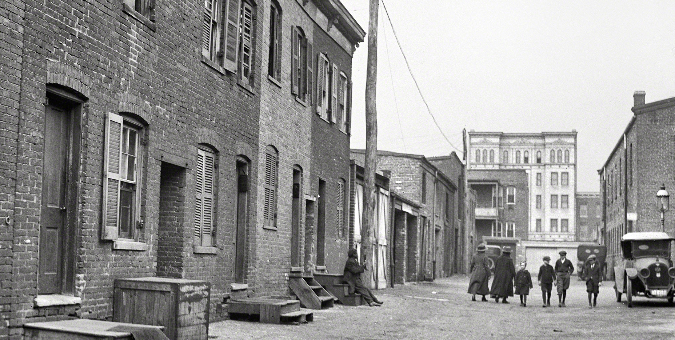
Blagden Alley was one of the most infamous of the “blind” alleys. This means that it had dark corners and dead ends in which nefarious activities could take place, and typically only had one way in and out. Social workers and the government focused mainly on the “blind” alleys when Washington DC tried to reform alley life in the early 1900s. The featured photo (and others that I found on the very cool Shorpy blog) gives you a good idea of what it must have been like. Compared to the wider streets and grand avenues of Washington, the alleys are narrow and confining.

Image of a “blind alley” from the 1912 Directory of the Inhabited Alleys
I’ve read what I can about life in these alleys, though information and books were challenging to find at times. The amazing images from the 1912 Directory of the Inhabited Alleys of Washington DC give you an excellent idea of what a blind alley would have been like.
(Bonus–notice the little stick figure attacking the other little stick figure in the image. Dastardly!)
However, Living In, Living Out by Elizabeth Clark Lewis was also surprisingly helpful, even though I approached it with other research goals in mind.
Another extremely useful book I found was James Berchert’s Alley Life in Washington. It spans over a century of alley life, yet it gave me several excellent images and ideas for the 1920s, and also led me towards valuable primary sources.
Despite the negativity portrayed in the 1912 assessment, the alleys became tiny neighborhoods all their own, and each had its own personality. Often they had their own nationality as well, since many African Americans, Germans. and Italians moved into specific alleys, and each would have their own baker, butcher, and…well…bookie.
Alley Life in Washington DC, Today

Blagden Alley, 2013, Courtesy Google Street View
Unfortunately, (only historically and architecturally, of course) the reform movement that started in the early 1900s caused the alleys to be almost entirely rebuilt throughout the years. Many of them are simply parking lots today, and the larger ones, like Goat Alley, Snow Court, and Shepherd Alley (and yes, the infamous Blagden Alley as well) have been turned into condominiums. They have coffee shops, art galleries, and bars, and are usually some of the trendiest places to live in Washington DC.
However, Blagden Alley is also one that you can actually explore on Google Maps and get a street view of it. This way you can get a lingering idea of what the narrow houses, garages and winding twists and turns must have looked like back then.
Pingback: Mapping Disease: Tuberculosis in Chicago, 1906 | Mapping Urban Form and Society